Little Falls

Mt Charleston / Humboldt-Toiyabe National Forest / Spring Mountains National Recreation Area / Las Vegas, Nevada, USA

About Little Falls


Hiking Distance: about 1.4 miles round trip (Upper Cathedral Rock Trailhead); 1.7 miles round trip (Echo Trailhead)
Suggested Time: 60-75 minutes

Date first visited: 2017-04-22
Date last visited: 2020-08-11

Waterfall Latitude: 36.25569
Waterfall Longitude: -115.65605

Waterfall Safety and Common Sense

Little Falls was a surprisingly attractive and reliable spring-fed waterfall in the Mt Charleston area despite its name.

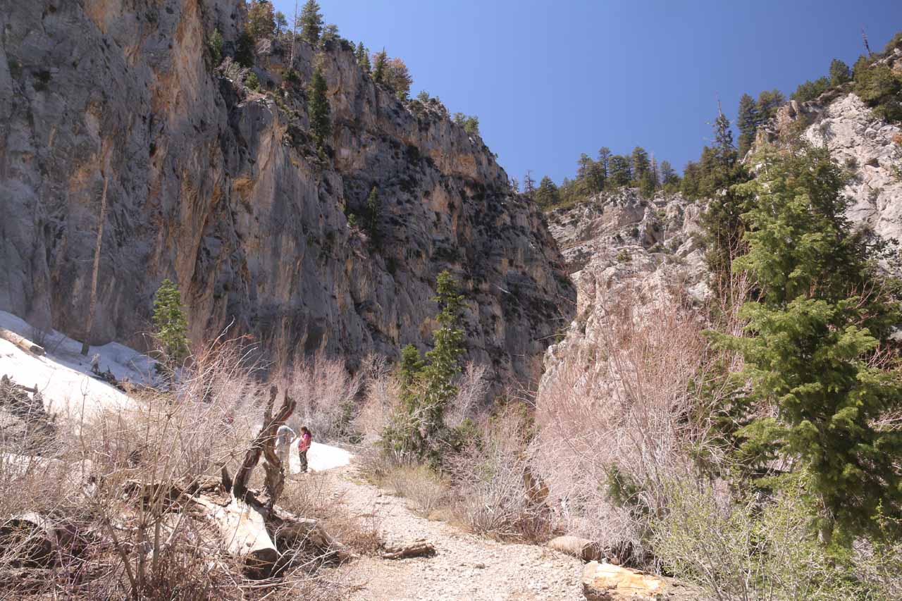
Not only did this roughly 30-50ft waterfall tumble over multiple drops, but it sat within a tightly-squeezed canyon beneath Cathedral Rock further adding to its scenic allure.

Mt_Charleston_489_08112020 - Little Falls in mid-August
Little Falls in mid-August

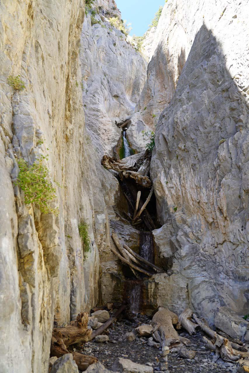
Unlike the popular but typically trickling Mary Jane Falls further up Kyle Canyon, Little Falls showed itself as a more legitimate waterfall with good flow even well into Summer.

Case in point, I visited this waterfall in mid-August 2020, and as you can see in the photo above, it still put on quite a show.

In fact, I’d argue that it was way more scenic than it was during my late April 2017 visit when a lot of snow covered it up.

Of course, given my observations, if I had to time a visit for maximum flow and minimum snow, then I’d guess that late June or early July would be best.

Mt_Charleston_423_04222017 - Little Falls mostly covered in snow when I showed up in late April 2017
Little Falls mostly covered in snow when I showed up in late April 2017

That said, the narrow canyon that Little Falls sat in tended to be in shade most of the day so conceivably it tended to hold onto its accumulated Winter snow.

I’d imagine that also helped enhance the reliability of this waterfall, especially since I noticed water pipes in the area.

Such piping infrastructure was a sure sign that someone else thought this spot had enough water to justify setting these things up here.

As for accessing Little Falls, there were two approaches – one from the Cathedral Rock Trailhead and another from the Echo Trailhead.

Hiking to Little Falls from the Cathedral Rock Trailhead

Mt_Charleston_569_08112020 - Context of the upper parking lot at the Cathedral Rock Trailhead with Cathedral Rock towering in the background
Context of the upper parking lot at the Cathedral Rock Trailhead with Cathedral Rock towering in the background

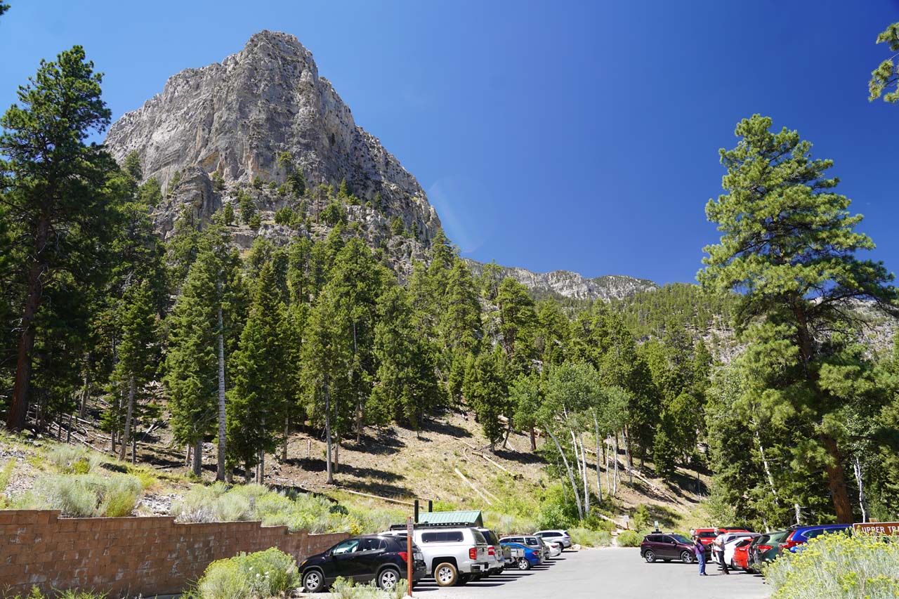
The most obvious and popular way to access Little Falls was by starting from the Upper Parking Lot for the Cathedral Rock Trailhead (see directions below).

According to my GPS logs (at least before both my GPS devices started going crazy), the hike was between 0.7-0.8 miles in each direction with a 300ft gain over that stretch.

From the end of the upper parking lot I followed an obvious trail past a trash container that followed the contours of the northern base of Cathedral Rock.

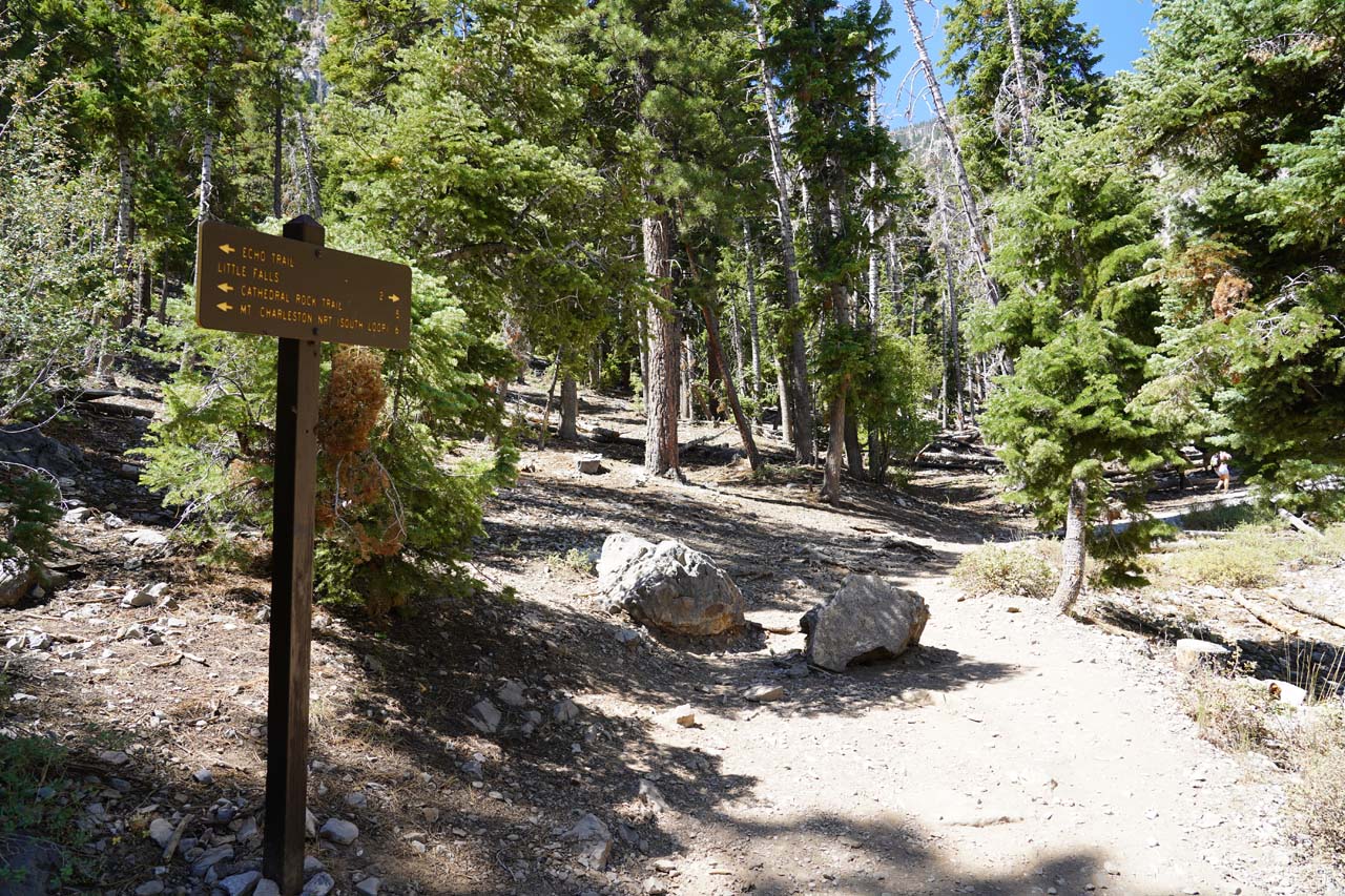
It followed this path west as it followed Kyle Canyon Road until it ascended to a trail junction almost a quarter-mile from the start.

Mt_Charleston_388_08112020 - Following the trail to Little Falls as it skirted along Kyle Canyon Road down below as seen on the approach from the Cathedral Rock Trailhead
Following the trail to Little Falls as it skirted along Kyle Canyon Road down below as seen on the approach from the Cathedral Rock Trailhead

I kept right (west) to continue heading towards Little Falls (ignoring incoming spur trails coming up from private properties).

The path on the left switched back towards the Cathedral Rock itself.

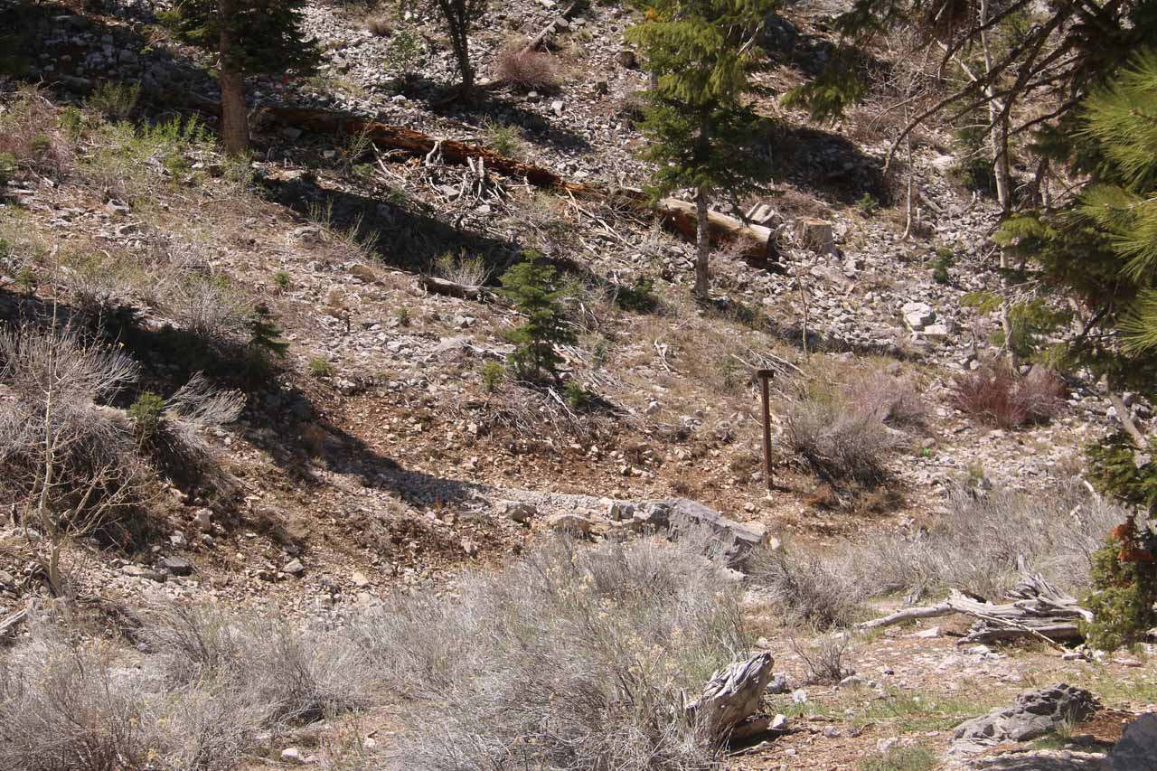
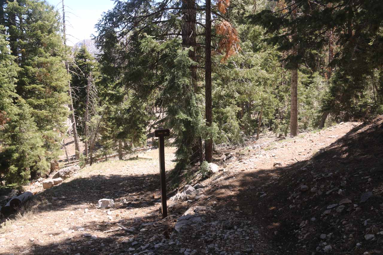
Anyways, as I continued on, I reached a signed trail junction in about 500ft, where the trail from the Echo Trailhead came in from the right.

Note that this sign at the trail junction was the first mention of Little Falls on this hike.

Mt_Charleston_400_08112020 - This sign at the trail junction with the Echo Trail was the only mention that I saw of Little Falls during my hike in August 2020
This sign at the trail junction with the Echo Trail was the only mention that I saw of Little Falls during my hike in August 2020

I kept going straight ahead from this junction, which continued a gradual climb as the trail also started to narrow the higher up it went.

Eventually, the path was pretty much within the tight canyon containing Little Falls, where I also started to notice water pipes as well as graffiti on the cliff walls.

I’d imagine that it was in this narrow canyon that my GPS devices started acting crazy as they couldn’t get a line-of-sight to the GPS satellites for a fix.

After another quarter-mile or so, the trail eventually went around a bend to the left, where it reached its dead-end right in front of the Little Falls.

Mt_Charleston_425_08112020 - Approaching the final bend in the narrow canyon concealing Little Falls at the end of the trail as seen in August 2020
Approaching the final bend in the narrow canyon concealing Little Falls at the end of the trail as seen in August 2020

According to my trip notes, it took me about an hour away from the car to complete this hike, including the moments I had enjoying the waterfall.

Hiking to Little Falls from the Echo Trailhead

When I first visited Little Falls, I actually started from the Echo Trailhead (see directions below).

Even though this trail was about 1.7 miles round-trip, I actually got lost trying to find Little Falls because there were lots of false trails conspiring to lead me astray.

In fact, I managed to find a bonus waterfall that I called “Medium Falls” during that moment where I was going the wrong way in pursuit of Little Falls.

Mt_Charleston_387_04222017 - Looking across the wash at an easy-to-miss sign near the Echo Trailhead, which led me in the direction of Little Falls
Looking across the wash at an easy-to-miss sign near the Echo Trailhead, which led me in the direction of Little Falls

Anyways, the way I ultimately did this hike correctly was by first crossing a dry wash next to the Echo Trailhead.

Right across the wash was an easy-to-miss sign pointing the way east saying “Trail”.

Note that I had previously made the mistake of following the wash to the west (in the direction of Mary Jane Falls).

In any case, I followed the trail as it climbed and then reached another fork where another “Trail” sign pointed to my right.

Mt_Charleston_400_04222017 - This signed pole was one of the confusing sections where the steeply ascending path on the right degenerated into a very steep scramble up to Cathedral Rock and it did not take me to the Little Falls
This signed pole was one of the confusing sections where the steeply ascending path on the right degenerated into a very steep scramble up to Cathedral Rock and it did not take me to the Little Falls

The trail continued to climb somewhat gradually before reaching a confusing trail junction with an “Echo Trail” sign pointing in both directions (left and right).

It turned out that I had to go left at this junction, but I did briefly explore going right from that sign, which degenerated into a very steep scramble and caused me to turn back.

Eventually after making it about 0.6 miles from the Echo Trailhead, I then finally reached the signed junction where the Little Falls Trail continued on the right.

Like with the Cathedral Rock Trailhead approach, this sign at the trail junction was the first mention of Little Falls (though I’m not even sure if that sign was there when I did it back in late April 2017).

Mt_Charleston_407_04222017 - After making a right at the next unsigned trail junction, I hiked the final stretch up the canyon leading towards the Little Falls, but I also had to deal with a lot of snow deeper into that canyon
After making a right at the next unsigned trail junction, I hiked the final stretch up the canyon leading towards the Little Falls, but I also had to deal with a lot of snow deeper into that canyon

In any case, I then followed the remaining 0.3-mile uphill to the end of the trail and the Little Falls as described earlier.

Authorities

Little Falls resides in the Humboldt-Toiyabe National Forest near Las Vegas in Clark County, Nevada. It is administered by the USDA Forest Service. For information or inquiries about the area as well as current conditions, you can try visiting their website.

Mt_Charleston_380_08112020 - Looking across the upper parking lot for the Cathedral Rock Trailhead where I can already see Cathedral Rock before starting my hike to Little Falls in August 2020
Mt_Charleston_386_08112020 - Looking down towards the turnoff for the Cathedral Rock Trailhead and Picnic Area as I started my hike to Little Falls in August 2020
Mt_Charleston_391_08112020 - Looking across Kyle Canyon Road towards the Cockscomb Ridge fronted by some private buildings or homes as I followed the trail to Little Falls from the Cathedral Rock Trailhead in August 2020
Mt_Charleston_392_08112020 - Looking back at the trail junction where the ascending path on the right went up towards Cathedral Rock while the path on the left went back to the Cathedral Rock Trailhead
Mt_Charleston_393_08112020 - The trail continued to follow Kyle Canyon Road on the way to Little Falls
Mt_Charleston_397_08112020 - Looking downhill to the right at a false path that led to private property as indicated by the yellow signs here.  Even though the maps say the Cathedral Rock Trailhead was down in this direction, the reality is that there's private property down there, and it's not the true trailhead as of my visit in August 2020
Mt_Charleston_535_08112020 - Looking back at the sign pointin the way to Little Falls, which also happened to be the same spot as the trail junction with the Echo Trail
Mt_Charleston_403_08112020 - Past the signed junction, the trail to Little Falls did a gradual to moderate climb though it was still fairly popular as I had to get past a few families like this one shown here during my August 2020 visit
Mt_Charleston_407_08112020 - The Little Falls Trail continuing to climb as it started to enter the mouth of the canyon containing the Little Falls as seen in August 2020
Mt_Charleston_409_08112020 - The Little Falls Trail continuing its ascent into the canyon containing Little Falls as the canyon walls continued to close in as seen during my visit in August 2020
Mt_Charleston_412_08112020 - The further up the canyon I went towards Little Falls, the more the canyon walls closed in and the vegetation became more persistent. Notice the water pipe at the bottom of this photo.  This was shot during my visit in August 2020.
Mt_Charleston_413_08112020 - Another look at that water pipe crossing the trail to Little Falls. You know that this place must have reliable water to even justify building this kind of water diversion infrastructure, which I'm guessing was originally meant for the residences of Mt Charleston further down the slope
Mt_Charleston_418_08112020 - Continuing to scramble further upstream in the tightening canyon in pursuit of Little Falls in August 2020
Mt_Charleston_421_08112020 - Approaching the final bend in the 'trail' leading up to the dead-end at Little Falls as seen in August 2020
Mt_Charleston_428_08112020 - My first clean look at Little Falls during my August 2020, which had surprisingly good flow
Mt_Charleston_432_08112020 - Closer look at Little Falls as I scrambled closer to its base to check out the log jam concealing parts of the waterfall itself during my visit in August 2020
Mt_Charleston_447_08112020 - Zoomed out context of Little Falls as seen in August 2020
Mt_Charleston_485_08112020 - Looking back down the canyon from the last turn before Little Falls as seen in August 2020
Mt_Charleston_492_08112020 - Context of some people enjoying Little Falls during my August 2020 visit
Mt_Charleston_493_08112020 - Another focused look at the impressive Little Falls in August 2020
Mt_Charleston_500_08112020 - Long-exposed look up at Little Falls from right at its base, where the log jam concealed the uppermost drops as seen in August 2020
Mt_Charleston_502_08112020 - Context of the tagging by Little Falls, which was definitely a sorry sight as seen in August 2020
Mt_Charleston_512_08112020 - Closeup look at some interesting flower blooming near Little Falls as clearly there's enough water here to sustain a good deal of plant and flower life here (as seen in August 2020)
Mt_Charleston_513_08112020 - My last look as more and more people were showing up at Little Falls during my August 2020 visit. I couldn't help but notice that the further downstream I went, the more of the upper drop of Little Falls that I could see
Mt_Charleston_516_08112020 - Descending the narrow canyon from Little Falls as I headed back to the Cathedral Rock Trailhead in August 2020
Mt_Charleston_519_08112020 - Approaching the mouth of the canyon containing Little Falls as I was leaving during the end of my visit in August 2020
Mt_Charleston_525_08112020 - Noticing this damaged water pipe on the way back from Little Falls in August 2020
Mt_Charleston_529_08112020 - Looking back at more people heading up the canyon towards Little Falls so for sure it was going to be crowded there, and thus it would be harder to socially distance.  So I was glad I was leaving to wrap up my visit in August 2020
Mt_Charleston_532_08112020 - Heading back down the Little Falls Trail towards the Cathedral Rock Trailhead in August 2020
Mt_Charleston_551_08112020 - Following the remainder of the trail back to the Cathedral Rock Trailhead as it skirted along Kyle Canyon Road as seen in August 2020
Mt_Charleston_382_04222017 - Looking back towards the Echo Trailhead as I pursued the Little Falls during my late April 2017 adventure.  This photo and the rest of the photos in this gallery were taken from that trip
Mt_Charleston_303_04222017 - This is the key point to remember. If you find yourself still hiking in this dry wash after more than a minute of leaving the Echo Trail, then you've most likely missed the signed turnoff to continue on the Echo Trail.  So turn back and look for the correct turnoff  across the wash and to the left near the trailhead
Mt_Charleston_394_04222017 - After ascending for the next 0.2 miles or so on my April 2017 hike to Little Falls, the trail flattened out a bit and I then encountered this trail post, which kept me going right and prevented me from taking the false trail on the left
Mt_Charleston_404_04222017 - When I finally found the correct 0.3-mile spur path to Little Falls, I started to encounter some snow patches during my late April 2017 visit. Little did I realize that this was a foreshadowing of what was to come later
Mt_Charleston_409_04222017 - Dealing with a lot of snow on my way up the canyon towards the Little Falls as the canyon closed in during my late April 2017 visit
Mt_Charleston_415_04222017 - I had to follow the footprints to ensure that I was going the right way to get to Little Falls during my late April 2017 visit
Mt_Charleston_419_04222017 - Getting closer to Little Falls as the canyon was about to round a bend just behind the graffiti as seen in my late April 2017 visit
Mt_Charleston_420_04222017 - Looking back towards the snowy section that I had walked on so far in my late April 2017 effort to reach the Little Falls
Mt_Charleston_421_04222017 - Brighter look back at the slippery snow patch on my way up to the Little Falls in late April 2017
Mt_Charleston_429_04222017 - Finally finding the Little Falls on my late April 2017 visit
Mt_Charleston_431_04222017 - Zoomed in on the only part of Little Falls that I could see above the snow in late April 2017
Mt_Charleston_439_04222017 - Looking back downstream from Little Falls as the cliff walls were getting incident light bouncing off the adjacent canyon walls during my late April 2017 visit
Mt_Charleston_446_04222017 - Going back on the snow field as I was leaving Little Falls to cap off this rather disappointing visit in late April 2017
Mt_Charleston_455_04222017 - Back on drier terrain as I was making the downhill hike back to the Echo Trailhead after having had my fill of Little Falls in late April 2017
Mt_Charleston_463_04222017 - Continuing on the return hike as I was coming back from Little Falls in late April 2017
Mt_Charleston_469_04222017 - Looking towards Mt Charleston Village at the foot of the imposing Cockscomb Ridge as seen from the Echo Trail as I was heading back from Little Falls in late April 2017
Mt_Charleston_481_04222017 - Descending back down to the wash near the Echo Trailhead to end off my late April 2017 hike
Mt_Charleston_483_04222017 - Looking in the other direction further up Kyle Canyon on my way back from Little Falls towards the Echo Trailhead
Mt_Charleston_488_04222017 - Finally making it back to the Echo Trailhead to end my disappointing Little Falls visit in late April 2017


To access Little Falls, I could have started hiking from the Cathedral Rock Trailhead or the Echo Trailhead.

I’ll describe directions to both from the Las Vegas so you can choose how you’d like to start this excursion.

Mt_Charleston_006_iPhone_08112020 - Driving up the Kyle Canyon Road into Mt Charleston as I pursued Little Falls
Driving up the Kyle Canyon Road into Mt Charleston as I pursued Little Falls

So from the Las Vegas Strip, I drove onto the I-15 north towards the US95 Freeway heading west.

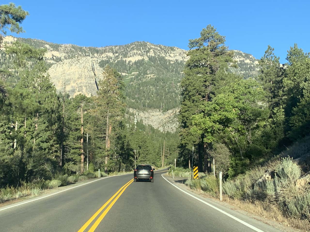
I then followed the US95 for about 16 miles before turning left onto Kyle Canyon Rd.

Then, I drove on Kyle Canyon Rd (NV-157) for about 20 miles going through the village of Mt Charleston.

At this point, I had a choice of leaving the NV-157 by turning right onto Echo Drive or keeping left to cross the bridge and continue on Kyle Canyon Rd.

Mt_Charleston_300_04222017 - Looking back at the Echo Trailhead, which was my starting point for the Little Falls adventure when I did it late April 2017
Looking back at the Echo Trailhead, which was my starting point for the Little Falls adventure when I did it late April 2017

Turning right onto Echo Drive would have led to the Echo Trailhead (as there was a brown sign for Trail Canyon and Mary Jane Falls directing me to turn this way at this point).

The Echo Trailhead was another 0.1-mile on Echo Drive, where there was a small parking area on the left.

Keeping left to continue on the Kyle Canyon Rd (NV-157), the road crossed a bridge as it curved and continued past some private buildings.

Eventually, I reached the signed turnoff for Cathedral Rock on the right, which was about a half-mile from the Echo Rd turnoff.

Mt_Charleston_555_08112020 - Looking back at the upper parking lot for the Cathedral Rock Trailhead, which was my starting point for the Little Falls adventure when I did this hike in August 2020
Looking back at the upper parking lot for the Cathedral Rock Trailhead, which was my starting point for the Little Falls adventure when I did this hike in August 2020

After ascending the spur road into the Cathedral Rock Trailhead area, there was a lower parking lot straight ahead as well as the upper parking lot on the right.

The one on the right was the closest starting point for Little Falls though I suspect that the one on the left might have been closer for Cathedral Rock (because that one seemed to be full).

Overall, this 44-mile drive would take around an hour after leaving the New York New York Hotel and Casino.

To give you some context, Las Vegas was about 265 miles (about 4 hours drive; possibly more with traffic and drivers ignorant of the keep right except to pass highway etiquette) northeast of Los Angeles, California, 121 miles (2 hours drive) southeast of Beatty (near Furnace Creek in Death Valley), 99 miles (over 90 minutes drive) north of Laughlin, 123 miles (about 2 hours drive) southwest of St George, Utah, 276 miles (about 4.5 hours drive) west of Page, Arizona, and 424 miles (about 6 hours drive) southwest of Salt Lake City, Utah.

Find A Place To Stay

Nearly 360 degree sweep showing all the running water around me as well as the surrounding cliffs before panning down the Little Falls


Having a brief moment of alone time at the Little Falls


Pretty thorough examination of the Little Falls from further downstream to reveal more of its uppermost drop before approaching the base


180 degree sweep of the Little Falls mostly obstructed by snow and some kind of log jam

Related Top 10 Lists

No Posts Found

Trip Planning Resources


Nearby Accommodations


Tagged with: las vegas, clark county, mt charleston, nevada, waterfall, medium falls, kyle canyon, echo trail


Visitor Comments:

Got something you'd like to share or say to keep the conversation going? Feel free to leave a comment below...

No users have replied to the content on this page


Share your thoughts about what you've read on this page

You must be logged in to submit content. Refresh this page after you have logged in.

Visitor Reviews of this Waterfall:

If you have a waterfall story or write-up that you'd like to share, feel free to click the button below and fill out the form...

No users have submitted a write-up/review of this waterfall


Have you been to a waterfall? Submit a write-up/review and share your experiences or impressions

Review A Waterfall

Nearest Waterfalls

The Waterfaller Newsletter

The Waterfaller Newsletter is where we curate the wealth of information on the World of Waterfalls website and deliver it to you in bite-sized chunks in your email inbox. You'll also get exclusive content like...

  • Waterfall Wednesdays
  • Insider Tips
  • User-submitted Waterfall Write-up of the Month
  • and the latest news and updates both within the website as well as around the wonderful world of waterfalls


How To Build A Profitable Travel Blog In 4 Steps

Johnny Cheng

About Johnny Cheng

Johnny Cheng is the founder of the World of Waterfalls and author of the award-winning A Guide to New Zealand Waterfalls. Over the last 2 decades, he has visited thousands of waterfalls in over 40 countries around the world and nearly 40 states in the USA.
Read More About Johnny | A Guide to New Zealand Waterfalls.