"Medium Falls"

Mt Charleston / Humboldt-Toiyabe National Forest / Spring Mountains National Recreation Area / Las Vegas, Nevada, USA

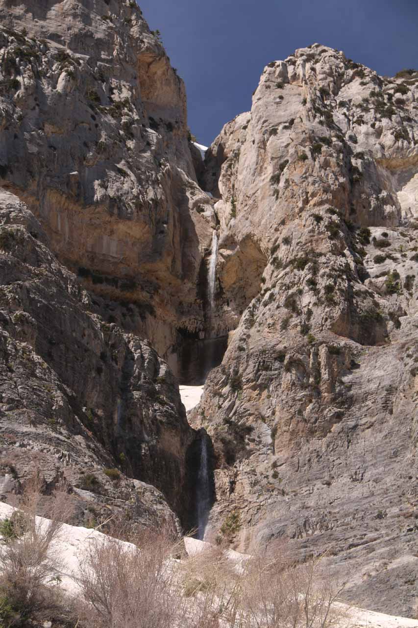
About “Medium Falls”


Hiking Distance: 1.5-3 miles round trip with scrambling
Suggested Time: 90 minutes

Date first visited: 2017-04-22
Date last visited: 2017-04-22

Waterfall Latitude: 36.26214
Waterfall Longitude: -115.66415

Waterfall Safety and Common Sense

“Medium Falls” was a name I made up for this waterfall because it sat in between Little Falls and Big Falls on the northeast-facing slopes of Kyle Canyon.

I could have easily called it “Lost Falls” because this was an accidental waterfall that I never knew existed until I got lost looking for Little Falls and stumbled upon this one.

Mt_Charleston_336_04222017 - 'Medium Falls'
‘Medium Falls’

In fact, even after the hike was over, I scoured the internet and looked at my Topo Maps trying to figure out what this waterfall was supposed to be called.

But alas, I couldn’t find anything.

I was incredulous at the thought that this was a nameless waterfall, especially when it seemed to have better flow than Big Falls on the day that I found this waterfall in late April 2017.

In fact, I could even argue that this waterfall even had better flow than the Mary Jane Falls on the day of my visit.

Mt_Charleston_332_04222017 - Context of the accidental waterfall that I'm calling 'Medium Falls' fronted by an extensive snow field
Context of the accidental waterfall that I’m calling ‘Medium Falls’ fronted by an extensive snow field

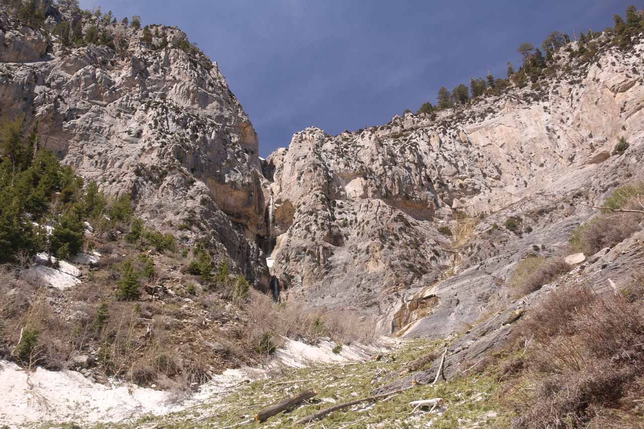
Anyways, this seemingly unknown waterfall fell in two big drops (probably with a cumulative height of at least 200ft or so).

It didn’t seem to have any obvious signage nor other infrastructure adding some legitimacy to the falls.

Nevertheless, I’ll keep using this informal name for the falls until someone sets me straight.

Scrambling up to the “Medium Falls”

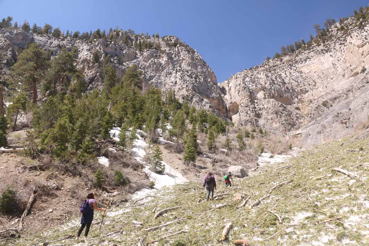
I basically became aware of this waterfall when I started from the Echo Trailhead and hiked a fair distance along a dry wash.

Mt_Charleston_303_04222017 - Missing the sign at the Echo Trailhead and scrambling along this wash which got me to accidentally find the 'Medium Falls'
Missing the sign at the Echo Trailhead and scrambling along this wash which got me to accidentally find the ‘Medium Falls’

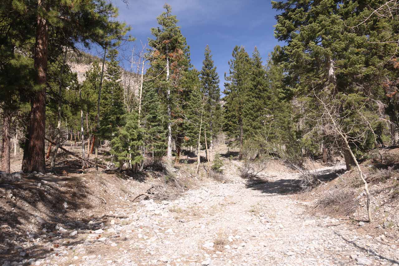
Apparently, I had missed the correct signpost to continue on the Echo Trail towards Little Falls, and I wound up scrambling for about a quarter-mile along a wash before I noticed an unknown waterfall high up on the mountain’s slopes to my left.

It was at this point that I basically tried to follow any faint path or clues of people being here before.

I’d eventually make it up to a bouldery creek bed before encountering a pretty deep snow field.

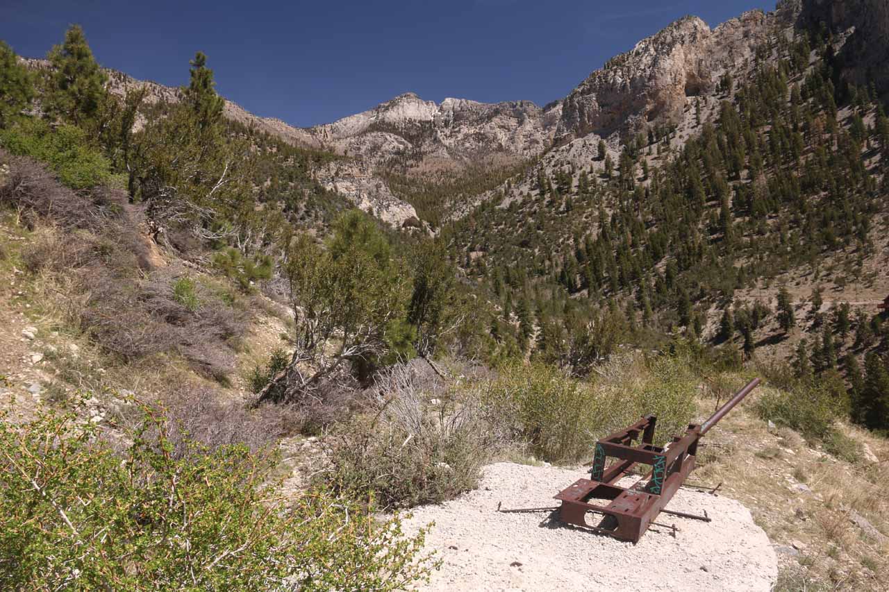
It continued further up the slope towards the base of the “Medium Falls”, and yet it really wasn’t until I reached the creekbed did I finally start to see faint trails going past some artifacts.

Mt_Charleston_353_04222017 - Following this group of folks who also decided to spontaneously pursue what I'm calling the 'Medium Falls'
Following this group of folks who also decided to spontaneously pursue what I’m calling the ‘Medium Falls’

For example, I saw the remnants of a trailer as well as some things like empty bottles and pieces of old signs strewn along the way.

Once I was on the snow field, the climb got steeper and the footing was a bit more slippery thanks to the snow.

After about 0.8 miles from the Echo Trailhead, I’d reach a point where I decided that I had gotten a good enough view of “Medium Falls” before I turned around.

I could have continued further up the steep snow field to get right up to the bottom of the two-tiered waterfall, but it was hard enough to get to this point in the first place, and I didn’t see the value in continuing on.

Scrambling down from the “Medium Falls”

Mt_Charleston_357_04222017 - I had climbed high enough to get this elevated view of the Cockscomb Ridge and Mt Charleston Village on my way back from the 'Medium Falls'
I had climbed high enough to get this elevated view of the Cockscomb Ridge and Mt Charleston Village on my way back from the ‘Medium Falls’

When I went back down, the steep snow field kind of forced me to essentially “ski without skis” as I’d essentially run then jump in mini-self-made-switchbacks.

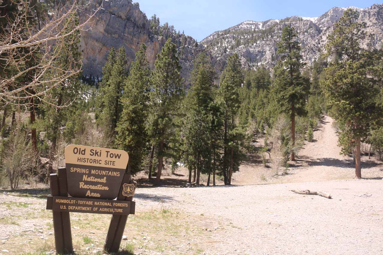
Once I got back down to the faint trail on the left side of the creekbed (facing downhill), I then pretty much continued following the trail directly downhill (keeping right at one obvious fork).

I was eventually deposited in an open area with a sign saying “Old Ski Tow”.

This clearing happened to be next to the parking lot for Trail Canyon (which was right at the start of the unpaved Mary Jane Falls Road).

Mt_Charleston_367_04222017 - One of the strange relics that I saw during my scramble to and from 'Medium Falls' in the Mt Charleston area
One of the strange relics that I saw during my scramble to and from ‘Medium Falls’ in the Mt Charleston area

In fact, this made me wonder if it would have been better to start the hike from this parking lot instead of the Echo Trail if the goal was to get up to “Medium Falls”.

The distance hiked from my turnaround point to the Old Ski Tow was about a half-mile.

To complete the hike, I pretty much followed the wash from the Old Ski Tow all the way back to the Echo Trailhead.

It was not a formal trail, and there was one section where there was actually water before it disappeared back into the ground again.

There was also a couple of crosses hidden in the area perhaps to commemorate some loved ones who might have died here.

Mt_Charleston_376_04222017 - When I returned from the 'Medium Falls' I somehow found myself near this sign for the Old Ski Tow, which was actually by a different parking lot and trailhead than the Echo Trailhead that I had started from
When I returned from the ‘Medium Falls’ I somehow found myself near this sign for the Old Ski Tow, which was actually by a different parking lot and trailhead than the Echo Trailhead that I had started from

In any case, the remainder of the scramble took me about 15 minutes as I went roughly a half-mile.

So overall, I had gone about a 1.8-mile loop beginning and ending at the Echo Trailhead.

However, in hindsight, I would have been better off hiking from the Old Ski Tow / Canyon Trailhead in a one-mile out-and-back hike and scramble.

The difficulty score reflected the effort it took for me to do this hike from the Echo Trailhead.

Authorities

“Medium Falls” resides in the Humboldt-Toiyabe National Forest near Las Vegas in Clark County, Nevada. It is administered by the USDA Forest Service. For information or inquiries about the area as well as current conditions, you can try visiting their website.

Mt_Charleston_298_04222017 - Looking ahead from the Echo Trailhead, where I had gotten started to pursue Little Falls, but ultimately found myself finding 'Medium Falls' instead
Mt_Charleston_305_04222017 - While looking for any sign of water or the likelihood of finding Little Falls, I noticed this tall waterfall way upslope, which I at first had mistaken for Little Falls but then realized that this might be something else (Echo Falls?  or was it informally named which I came up with 'Medium Falls'?)
Mt_Charleston_310_04222017 - As I was scrambling to look for a path to get up to that waterfall I saw way upslope, I kept seeing signs of people leaving stuff behind or leaving behind chopped trees, which made it all the more confusing
Mt_Charleston_312_04222017 - I eventually scrambled up to this wash or creek way downslope from that waterfall I was trying to get close to (which I'll call 'Medium Falls')
Mt_Charleston_314_04222017 - Looking up towards the head of Kyle Canyon in the direction of where I believe Mary Jane Falls was supposed to be as well as Big Falls
Mt_Charleston_319_04222017 - Looking back across Kyle Canyon as I had finally scrambled up to a faint trail alongside the creekbed
Mt_Charleston_320_04222017 - Following the faint trail alongside the creek bed in pursuit of the 'Medium Falls'
Mt_Charleston_323_04222017 - A trio of hikers went ahead of me and also pursued the 'Medium Falls' but then they were significantly slowed down by the presence of snow
Mt_Charleston_325_04222017 - I wasn't alone on this scramble as I eventually caught up to this trio of folks at the start of the snow field, who might have been just as lost as I was and decided to pursue the 'Medium Falls'
Mt_Charleston_328_04222017 - It was pretty much all snow hiking from here on up to the 'Medium Falls'
Mt_Charleston_329_04222017 - Looking back down the snow field as I had passed the trio of hikers and continued to make my way up towards the 'Medium Falls'
Mt_Charleston_330_04222017 - As I got closer to the 'Medium Falls', I realized that there was a second drop right below the taller main drop
Mt_Charleston_333_04222017 - Looking back downslope towards the trio of hikers I had now left way behind whilst on the snow field in pursuit of 'Medium Falls'
Mt_Charleston_334_04222017 - Looking up at the context of 'Medium Falls' to the left with more snow and cliffs to the right of it
Mt_Charleston_339_04222017 - Bright look up at the 'Medium Falls' as I was pretty much as far up as I was probably willing to go
Mt_Charleston_342_04222017 - This was probably the last clean view of 'Medium Falls' that I was going to get as getting further up the steep slope meant more slipping and sliding (hopefully not falling in) on the snow
Mt_Charleston_343_04222017 - Starting to make my way back down the snowy canyon after decided to turn around from my pursuit of 'Medium Falls'
Mt_Charleston_347_04222017 - Looking back down towards Kyle Canyon from 'Medium Falls' where I could see the desert basin on the horizon
Mt_Charleston_348_04222017 - Another look back up at the 'Medium Falls' in context with some neighboring cliffs as I decided to head back down
Mt_Charleston_363_04222017 - Last look back up towards the 'Medium Falls' as I continued to make my way back down the snowy canyon
Mt_Charleston_368_04222017 - On the hike back down, I followed this trail, which also went past some artifacts like the remnants of this trailer. It would ultimately deposit me towards the Old Ski Tow Historic Site
Mt_Charleston_377_04222017 - Scrambling along this wash as I was trying to get back to the Echo Trailhead from the Old Ski Tow Historic Site
Mt_Charleston_380_04222017 - I had passed by this shrine or grave or something on the return hike between Old Ski Tow and the Echo Trailhead. Perhaps this was in memory of someone who had died here
Mt_Charleston_382_04222017 - Finally making it back to the Echo Trailhead though in hindsight, the Old Ski Tow and Trail Canyon Parking Lot was the better place to start the hike for 'Medium Falls'


From the Las Vegas Strip, I drove onto the I-15 north towards the US95 Freeway heading west.

I then followed the US95 for about 16 miles before turning left onto Kyle Canyon Rd.

Mt_Charleston_300_04222017 - I actually started my 'Medium Falls' misadventure from the Echo Trailhead though I had originally pursued Little Falls
I actually started my ‘Medium Falls’ misadventure from the Echo Trailhead though I had originally pursued Little Falls

Then, I drove on Kyle Canyon Rd (NV-157) for about 20 miles going through the village of Mt Charleston then leaving the NV-157 by turning right onto Echo Drive (there was a brown sign for Trail Canyon and Mary Jane Falls directing me to turn this way at this point).

Continuing another 0.1 mile on Echo Drive, I then turned left onto the small parking area for the Echo Trailhead.

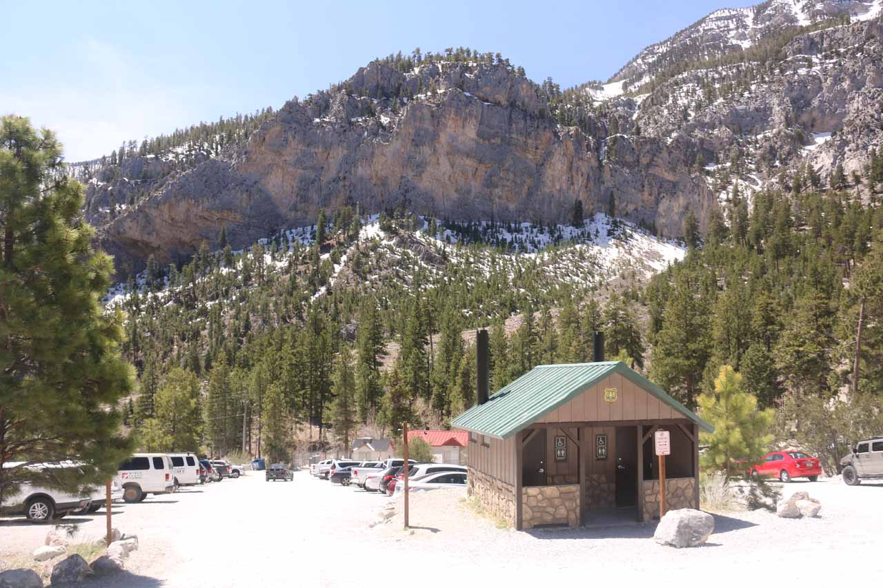
Alternatively, I could have also continued another 0.3 miles beyond the Echo Trailhead on Echo Drive before finding parking at the Trail Canyon Parking Lot right at the turnoff for the Mary Jane Falls Trailhead and right next to the Old Ski Tow clearing.

In hindsight, it might have been a more sensible trailhead to reach “Medium Falls” from the Old Ski Tow clearing than the Echo Trailhead.

Mt_Charleston_386_04222017 - This was the Trail Canyon Trailhead Parking Lot, which was close to the Old Ski Tow Historic Site, and it might have been a more sensible trailhead to pursue the 'Medium Falls'
This was the Trail Canyon Trailhead Parking Lot, which was close to the Old Ski Tow Historic Site, and it might have been a more sensible trailhead to pursue the ‘Medium Falls’

Overall, this 44-mile drive would take around an hour after leaving the New York New York Hotel and Casino.

To give you some context, Las Vegas was about 265 miles (about 4 hours drive; possibly more with traffic and drivers ignorant of the keep right except to pass highway etiquette) northeast of Los Angeles, California, 121 miles (2 hours drive) southeast of Beatty (near Furnace Creek in Death Valley), 99 miles (over 90 minutes drive) north of Laughlin, 123 miles (about 2 hours drive) southwest of St George, Utah, 276 miles (about 4.5 hours drive) west of Page, Arizona, and 424 miles (about 6 hours drive) southwest of Salt Lake City, Utah.

Find A Place To Stay

180 degree sweep back and forth of an unknown waterfall that was between Little Falls and Big Falls that I accidentally stumbled upon while looking for Little Falls

Related Top 10 Lists

No Posts Found

Trip Planning Resources


Nearby Accommodations


Tagged with: las vegas, clark county, mt charleston, nevada, waterfall, medium falls, kyle canyon, echo trail, lost, old ski tow


Visitor Comments:

Got something you'd like to share or say to keep the conversation going? Feel free to leave a comment below...

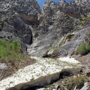
Cool waterfall indeed July 16, 2023 12:37 am by Vio Mill - Thanks to your website we explored this waterfall today. It is the beginning of July and because this past winter we had a lot of snow here on Mount Charleston area, all the waterfalls are still flowing! I would also like to mention that there is another waterfall just on the right of the Medium… ...Read More

Share your thoughts about what you've read on this page

You must be logged in to submit content. Refresh this page after you have logged in.

Visitor Reviews of this Waterfall:

If you have a waterfall story or write-up that you'd like to share, feel free to click the button below and fill out the form...

No users have submitted a write-up/review of this waterfall


Have you been to a waterfall? Submit a write-up/review and share your experiences or impressions

Review A Waterfall

Nearest Waterfalls

The Waterfaller Newsletter

The Waterfaller Newsletter is where we curate the wealth of information on the World of Waterfalls website and deliver it to you in bite-sized chunks in your email inbox. You'll also get exclusive content like...

  • Waterfall Wednesdays
  • Insider Tips
  • User-submitted Waterfall Write-up of the Month
  • and the latest news and updates both within the website as well as around the wonderful world of waterfalls


How To Build A Profitable Travel Blog In 4 Steps

Johnny Cheng

About Johnny Cheng

Johnny Cheng is the founder of the World of Waterfalls and author of the award-winning A Guide to New Zealand Waterfalls. Over the last 2 decades, he has visited thousands of waterfalls in over 40 countries around the world and nearly 40 states in the USA.
Read More About Johnny | A Guide to New Zealand Waterfalls.