Follow a tumbling, churning, whitewater creek upstream as it thunders through a narrow gorge of glacier-polished rock on your way to a waterfall that drops 301 feet in a single plunge. Admire numerous small waterfalls and cascades and two significant ones, all in less than two miles. This is the Comet Falls trail.
From the parking lot, elevation 3650 feet, start out on the smooth wide trail flanked by trees young and old. In 0.3 mile, encounter a stout bridge over Van Trump Creek. From the center of the bridge, you can look downstream and catch a glimpse of the roadway (and possibly other sightseers) below Christine Falls. Look upstream at white water churning through a rocky channel. There’s more ahead.
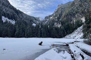
The trail continues along Van Trump Creek, often within sight of it, and never out of earshot. After a half mile from the trailhead, the trail begins to alternate between forest and openings, as it passes below talus slopes and an andesite formation. Van Trump Creek is wider here and not so turbulent.
At 1.2 miles, the trail scales a rock face on a crib ladder. This safe passage was constructed by WTA and other trail crews, after a slide forced a trail closure in 2012.
Continue 0.4 mile to where you meet a tributary coming from the right. A sign reads “Comet Falls 200 feet”. This refers to the first clear view of the namesake falls, but the real attraction at this point is the tributary, East Fork Van Trump Creek, which roars into view in a three-tiered plunge totaling 124 feet: Bloucher Falls. Arrive early on a sunny the day to see a circling mist sparkling in the sunlight. This falls can be quite pretty, well worth a stop for photos.
Cross the East Fork on a footlog, then go left below the bank until you find the trail again. Very soon, Comet Falls comes into view between the trees. For a closer look, hike the final 0.2 mile, past evidence of major wind damage in the form of snapped-off trees, then up a few steep switchbacks to an obvious transition at a junction. The trail to the right continues steeply up to Van Trump Park, but an obvious boot path to the left provides a way for those who want to be closer to the plunge pool. But beware: Not only can swirling winds cause the spray to drench you, but rockfall from above is a very real hazard.
Comet Falls

-
 Length
- 3.8 miles, roundtrip
-
 Elevation Gain
- 1,250 feet
-
 Highest Point
- 4,875 feet
Follow a tumbling, churning, whitewater creek upstream as it thunders through a narrow gorge of glacier-polished rock on your way to a waterfall that drops 301 feet in a single plunge. Admire numerous small waterfalls and cascades and two significant ones, all in less than two miles. This is the Comet Falls trail.
Continue reading
Parking Pass/Entry Fee
National Park PassHiking Comet Falls

WTA worked here in 2013 and 2012!
Map & Directions
 Trailhead
Before You Go
Between May 24 and September 2, visitors to this trail need a reservation to enter the park as well as a national park pass.
Parking Pass/Entry Fee
National Park PassWTA Pro Tip: Save a copy of our directions before you leave! App-based driving directions aren't always accurate and data connections may be unreliable as you drive to the trailhead.
Getting There
Learn how to secure your timed-entry permit for Mount Rainier National Park here.
Enter the park from the west entrance to Mount Rainier National Park, 13.5 miles east of Elbe on State Route 706. Drive 10.2 miles to the Comet Falls Trailhead parking lot on the left.
From the east entrance, or within the park, travel west five miles from the junction of Paradise Road and Stevens Canyon Road, to the parking lot a quarter mile past the Christine Falls Viewpoint. There is parking for 16 automobiles and a few motorcycles, but no trailhead amenities.